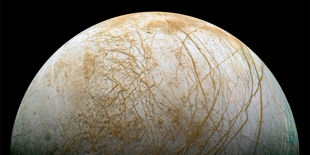
NASA engineer Kevin Gill stitched together images from two 1998 observations of Europa by the Galileo spacecraft to create this.
Processed using low resolution color images (IR, Green, Violet) from March 29 1998 overlaying higher resolution unfiltered images taken September 26 1998. Map projected to Mercator, scale is approximately 225.7 meters per pixel, representing a span of about 1,500 kilometers.